Thanks for being a sport and supported the write up of Day 1 SAC in my blog last week. As promised, this is Day 2 of the write up. They say the distance per day in SAC is not the killer, it is the task of waking up in less than 8hours later (depending on what time you got back, or sleep the night before) before heading out for the next day route. As luck has it, 2014 15th Anniversary race saw the organiser putting the tougher day on Day 2. It has always been a tougher Day 1 the past few years, but yes; like the race, they love to mess you up mentally. When the Organiser say "estimated 38km", be prepared for something 10-20% extra, and that was what waited for many of us on Day 2.
 |
| The night before |
Day 2 Rise And Shine
Most, if not all of us woke up at about 5am on Day 2. It was still dark and did not see sunlight until circa 5.45am. The morning fresh crisp air and cool temperature around Poring Hotspring made one feel lazy to actually wake up. More so with DOMS or Delayed Onset Muscular Syndrome where the quads are begging for mercy and the calves are asking for an easier day. Factor in the blisters acquired on Day 1, you get the idea.
 |
| Rise and Shine (and suffer) people! |
Of course, we have the chirpy ones. Here, a groupfie with the race director, Aman Avtar.
 |
| Thumbs up, always! |
A quick race check in and briefing were given. Till that morning, no one has any idea just how the route will be apart from the first Checkpoint CP1 situated about 13km away.
 |
| And of course, the compulsory "peace" before race start |
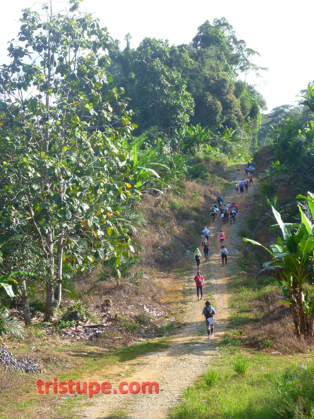
Getting to CP1 will require some good sense of direction, as I counted no less than 3 places someone will go take the wrong turn if they did not pay sufficient attention to the race briefing and the race guidance given out.
 |
| The faster ran, the more relaxed also (pretended to) run. |
The route bring the participants through the back portion of Poring Hotspring, and if you has been to Poring before, you know the back portion is nothing but gravel road and trails. We passed the bridge that link across the Langanan waterfall river. There is always a reason for groupfie when the time is right.
 |
| A groupfie is anytime! |
Day 2 for me and wifey was to continue the good pace we had on Day 1. Last year, we came in last on all three days with wifey just recovering from the accident while cycling. With her recovering 95% and has since jumped onto the trainer (bike trainer) for months, the fitness level has been elevated.
 |
| And small streams crossing...that many tried to avoid at Km0.8 |
 |
| But not champion here...that happily ran through the cold stream at 7.30am! |
About 1km into the day, there was two things that hit me. 1. How hot it will progress on Day 2; and 2. Damn, this 13km will be a blardy climb!
 |
| Likely the last "flat" we will see for this section |
I wasn't wrong, as I shouted out to wifey and asked her to pose for the photo below. What we did not know was how the rest of the elevation will be.
 |
| Whooopee! |
Climbs like these separate the strong from the average like me. Testing the quads and the calves. The back muscles takes a beating while the load on the shoulder added to the burden. With the sun shining down and the cool breeze blowing as we gained more elevation, the whole experience was almost a chain of oxymoron - good suffering, surprisingly predictable, brilliantly stupid.
 |
| Surprisingly Predictable |
Enjoy the pics below of the "Good Suffering".
It just doesn't end even after KM4. The sun was out in all it's glory. Shadow casted on the ground grew shorter, signalling the need for us to move faster, or risk groping in the dark later. In the rush, I keep reminding myself to "look behind", for that was what many may missed out if they keep concentrating to conquer what was in front for the day.
 |
| Simple life. I could retire here. Holiday home, perhaps? |
And when we look in front, there were more climbs. A reminder to wifey to "drink up", for dehydration spotted too late will cause more issues later.
Halfway up, I noticed a lot of banana trees. I told the story of two lost participants in 2010, and how the banana trees around them were "flatten" as if it has weight on top of them. So when I saw a comb of ripe banana laying on the side of the trail, I was tempted to nick one, only to be reminded in my head that we should respect the locals, and that I do not want something following me for the rest of the day.
 |
| Anyone took a bite? It was fat and juicy |
We proceed past the banana plantation and there was a moment of confusion, as some were not sure to turn left or right. It was quite worrying to notice many do not know how to do the most basic of map reading - to align the map north to the compass north. Some earlier runners may had turned the wrong way, but that will not be me that morning.
 |
| Adventure racers taking a break. The heat was overwhelming for them Seeking shelter by the side with shrubs |
As the route progresses towards the boundary of the Sabah National Park. We chance upon a clearing that was done in the name of agriculture. Trees felled, and could still be heard being felled (chainsaw buzzing) in the name of Oil Palm Plantation. It was sad to see these, and how the "untouched" was almost the last standing guardians of the Sabah National Park.
 |
| Not good at all |
 |
| The lone tall tree, or what was left of it on the far upper right. Could you imagine how grand she had stood for thousand of years? |
As it is, we are just "guests" allowed to pass through this piece of private land, and we shall proceed with our mission for the day : Get in, get out and get it done safely.Much like a mission and I was actually excited to enter the last bastion of trees that will link us to Sabah National Park jungle. I keep telling myself that to look out for signage, as that would signal us to turn right and down towards civilisation.
 |
| Check Point 0.5 ;-) |
There was a hut at the top of the climb. A member of the SARS (Sabah Amateur Radio Society) pictured above in orange t-shirt actually remember me and wifey from last year's race. Friendship rekindled. It is always awesome to share the race, even if it meant from two different (racer-organiser) perspectives. One thing for sure, the participants above enjoyed a well deserved 5-minute break from the heat.
 |
| Mandi Part 1 |
 |
| Mandi Part 2 |
 |
| Mandi Part 3 |
The cooling water from the rain water harvesting system - God sent.
 |
| The sun burning down |
As we move on to the next part of the trail, we entered the fringe of Sabah National Park. This part is crucial as Race Director mentioned a few times the night before to "Look for the big tree with the Sabah Park signage and turn right".
 |
| Nope, small signage |
 |
| Thumbs up for shelter from the sun |
The trails in the Park was superb. Trees marked with red-paint on the back demarcate the boundary.
 |
| Follow the red-marking until you find the big signage, they say |
Through the JVC Adixxion XA2 wide angle camera, this was how the inner of the jungle looked like
 |
| Undulating |
 |
| Selfie galore |
Major big trees, many 100feet tall lined the jungle. I hope they remain here for a long(er) time.
 |
| Lost sight of many people once I was in the jungle |
 |
| The Tree! |
Here is the funny thing - many missed this tree and signage. Including my wife that went ahead of me. It was scary to think that she can't hear me shout for her to stop, and she went on ahead further...until she chance upon the front pack that missed the signage and was lost!
 |
| :( |
However, there was no love lost there. We all learn in races and we know to look out for signs (like on Day 1, in the river with the stones stacked). Many of us need too much help to be in the wood. I bet if Waze can point the route in the jungle, I would see everyone holding their smart phones. However, this is a race and getting lost is expected. It is how you recover from taking the wrong turn that would serve as a lesson for the future races.
 |
| Backtrack! |
Being more experienced, i developed some semi-sentinel skill set to navigate in the jungle. Found the tree with the signage and we were easily 800m off course. I can only imagine those in the front pack - having to hike up a 40degree cliff for likely 2km before realising they went the wrong way.
 |
| OK. Correct way now |
The trails then navigate through a small section with heavy undergrowth, that again, will raise questions to those not familiar if it is indeed the correct path. I was sure that this was the correct way. With more people following behind, the burden for me is to lead them out and back to the trail.
 |
| Getting lost - all part of the plan |
At that point, I found out that a few has missed the right (as in correct) turning and went the wrong way, heading to CP7, which was "nearby". It was a downhill 3km route, which meant by the time they reached the wrong checkpoint (as in CP1...) they already added 6km extra and lost up to 45minutes if they are strong runners. For that mistake, the slower back markers (read : me and wifey), caught up without much effort.
 |
| No fun to be running down here, then realised you got lost and have to run up again |
Day 2 continue with superb views. To get to this level and take photos like the one below, you have to hike pretty high up (and at that point, elevation gain was already 900m...)
 |
| Wait for it! |
Every "peak" was thought to be the apex of the climb. We know better that it may be true. But who actually cares? Everyone need to go through the same route and best to enjoy the view as well.
 |
| Downhill? Finally. Sure? |
 |
| The sceneries made you feel so small in this world |
Then, there was a clearing we arrived at, with a landing that overlook the valley. The weather was superb (as in HOT) and the view spectacular.
 |
| Compulsory stop. Take 5. Enjoy the view. |
All it takes is setting the camera to time-lapse and start calling everyone for a group photo! See the sequence below.
 |
| Woi, mari-mari! |
 |
| OOoo... Photo opps! |
 |
| And within 5-seconds, you get the quorum! |
Thankfully, that last climb was absolutely the last for this sector. We went downhill and that took quite a task as the muscles sore from Day 1 tries to remember how to go downhill. I wasn't joking about the legs going jello. My utmost respect for those strong runners and adventure racers. Super humans!
 |
| View like these are normal in Day 2. Any place we can find shade, we hide for a while |
 |
| I bet Team 120 wished the ditch had water flowing...image how cooling it will be on your back! |
By the way, any of you noticed a scorpion trying to seek shelter from the heat? This is a big one. It crossed my path and then stopped. I had to take a pic since it appear to be posing for me.
 |
| Sorry sir, your attempt to stay invisible failed. |
Nearing CP1, we passed a small kampung. The kids were out in drove and best of all, there was a grocery store that we attempted to see if they have...ICE CREAM. It turned out the stock not going to arrive until next month. We then decided to take a short break from the heat and interact with the locals a bit.
 |
| Care free |
 |
| They obviously know the universal peace sign |
 |
| Simple life |
Here is a pic of the grocery shop
 |
| The commotion we created, the locals would had thought they are being taken over. |
 |
| Happy with his local soda |
The heat was a challenge, add on the dust and the loose gravel. My feet were covered in soot and this regularly get washed off when we cross streams and river. With the feet swelling and the heat radiating from the ground, I know I have at least 2-blisters forming on the ball of my feet. I decided not to do anything until the CP1, as I would need it to be cleaned appropriately and plaster added to prevent more damage.
 |
| These feet are made for walking |
By the way, how many of you played with a tire like this boy when you were growing up? Who needs toy when you can improvise?
 |
| Whoopeee! And barefooted too! |
And ended up in the grassy area without a care in the world.
 |
| Or creepy crawlies that make even grown up (city man) scream! |
Thankfully, CP1 was indeed 1km away. A slower than usual descent towards CP1 on broken cement road that exposes reinforced re-bars was a hazard if you trip and fall.
 |
| Love this old 4wd. |
Civilisation is good, more so after 13+km under the hot 39degrees heat - and it's not even noon yet.
 |
| CP1! Onwards! |
The reaction on wifey's face says it all. Hot (as in the weather)
 |
| Jump into water, yes? no? |
 |
| Heading out of CP1 towards CP2 they are |
CP1 was a hive of activities. Mainly with participants really taking it easy and resting. This was where I got my blisters treated too.
 |
| Behind - a river! |
A river were calling me, but I decided not to jump in as I do not want to get myself wet and find out where the chaffings were. Hanif and Kam on the other hand...It seemed they spent almost an hour in the water.
 |
| Hot man in cold water = win. Photo from Kam's album in FB |
 |
| Smelling Smelly Socks Session (4S) - fixing blisters. Photo from Pengiran Rosli. Thanks bro. |
 |
| The good people of SARS and Medic |
We re-loaded the water and started to head out to CP5 (as CP2,3 and 4 were for Adventure racers). Which promised to be another 10km worth of dusty hot experience. But not without the opportunity to lie down on the road! :D
 |
| Babe on the road |
As we move along the road to Kampung Perancangan along the gravel road, we passed a small school. Simple and yet, you wonder if more can be done to help the locals gain invaluable education.
 |
| A school with a field (background) bigger than most I've seen |
The sun continues to burn and the Garmin Fenix recorded consistent temperature on my arms. Bearing in mind that the reading is normalised somewhat as I splash water on myself and the arm. It may be 38, but certainly felt like 2 or 3 degree hotter.
 |
| Heat training |
And suddenly these Adventure racers on mountain bike were the envious of many of us...imagine being able to move faster than 9min/km pace. Haha.
 |
| Hitch A ride? |
We passed this home, it was taller than usual. I wonder is it because they built it for the view. I don't think this place will flood.
 |
| A good 8 feet high |
And each time a truck or vehicle passed us, dust and sand flies everywhere. The Buff (from TMBT) were superb in keeping the dust and heat away to manageable degree.
 |
| Wetting it gives better filtering effect |
And where there aren't any trucks, it helped in covering my head. I have a cap with me, but the buff did a great job as well. So those of you wanting to race SAC or TMBT or anything that will involve heat, loads of heat, go prepared.
 |
| Cheeky women behind. Wonder what she wants to do with the stick |
It was noon when we arrived halfway towards CP5. The sun casted a short shadow and believe me when I say I seek some shelther from this small stalls by the road side.
 |
| Some rain will be good |
This stall.
 |
| And do you see the level of honestly the village folks has? take and put money in the small yellow box! |
 |
| Skechers GoRunUltra - awesome on the gravels. |
With about 2 more km to the cross junction of Kampung Perancangan, the sun went into hiding for a while. It is a wonder how some respite from the heat helps with us moving a bit faster.
 |
| Paktor-robic |
Kampung Perancangan was familiar to me. It was indeed one of the compulsory stop in 2013 SAC. Only difference is that we came from the opposite direction.
 |
| Yes! Kampung Perancangan |
Even wifey recognised the place.
 |
| Thumbs up! CP5 is near! |
We did planned to take a dip in the river below. But we did not as it was too much effort to climb down (and up later).
 |
| Inviting |
So we headed to the cross-juntion and turned right. We recognised the route and thought it won't be the same as 2013. Turned back and bumped into Rosli, which then confirmed that we should be headed east, not south. The Adventure racer will head north towards some highway that leads to nowhere.
 |
| Towards CP5 |
As we cleared the climb towards CP5, we saw a bunch of participants resting at the roadside stalls. We decided to stop and refuel. Nothing beats sitting down and interacting with the rest.
 |
| Food! |
I ordered an iced-Milo. It was finished within 2-big sip. No joke.
 |
| yummeh! |
Rosli bought us drinks on Day 2. The bottle of ice cold water was shared. We bought money with us and in the interior of Sabah, things aren't expensive. You can feed yourself well with RM5.
 |
| Camera. Water. Good company. Bliss. |
How cheap? RM2.50 bought Rosli a hearty serving of hot meehoon with loads of chicken. Best of all, it is as good as home cooked without any artificial flavouring.
 |
| The stalls likely to hit sales target for the quarter in one day (that is Day 2 of SAC) |
Happy with the 15minutes rest, we headed to CP5. And again, it was the same place we came through (in opposite direction) in 2013. A river beckons.
 |
| CP5 - blue tents ahead! |
 |
| ok. choose your spot! |
I tell you, this river was the best thing ever that day.
 |
| are those human on the far left corner? |
 |
| Thumbs up |
You bet. This is a compulsory 15minutes stop for participants. The race organiser made it compulsory for all to stop and rest.
 |
| Join me in the water! |
Time is not taken for this 15mins. So what we did? we stayed in the water for a full 15mins!
 |
| Wooo! |
And what do we do for 15mins? Take photos lah!
 |
| Wetting yourself in river was never this fun |
 |
| If only it as deeper |
 |
| And cooler...as the water was actually warm. That was how hot the day was! |
 |
| Happy! |
LOL. Sorry. It was too much fun not to post these up at the river.
 |
| Submarine? |
 |
| OK! 15mins almost up! |
Dear Rosli managed to head to another shop over the river and got himself another cold drink. :D
 |
| Sirap Bandung with cincau inside |
 |
| And many more arrive to have a dip in the pool as we made our way out to CP6. |
You be surprised that the heat dried us up within the next 30mins.
 |
| Moving to CP6 |
The route to CP6 was an uphill climb passing by rubber plantations till the top/end of trails. A few moment of confusion and a quick regroup managed to pull us all at the right route again.
 |
| More climbs? Damn... |
 |
| And the sun came out blasting us all again |
 |
| It was a 20deg slope all the way up |
 |
| Which slowly turned into a sub 30-degree slope climb... |
The heat and the sweating dries up the wet clothing very fast. We found ourselves drenched in sweat instead of river water.
 |
| Drying up from the dip - 30mins later. |
Climbing up the trail was tough and it ended almost suddenly. It then lead into a reently cleared trail that was a plantation.
 |
| No clear trail, just follow instinct |
 |
| Happy with the shades. It was darker than usual and had to remove the sunnies |
Then the sky opened up and it started to rain as we exit the plantation. The view was superb and the wind was howling.
 |
| Rain! |
 |
| Based on experience, there is no point to take the ponco out... |
We decided not to take the ponco out as the heat generated from moving will make us sweat. It is one thing managing the cold, but it is another trying to pesprire through waterproof clothing (and that is why they invented those breathable wear that I can't afford?)
 |
| Valley that seems to go on and on |
The heat was off, that meant the time is also running out for daylight. We need to move faster else we will be groping in the dark.
 |
| Yay! (for what ah?) |
We caught up with the team ahead and they were all decked out in Poncos.
 |
| But rain stopped already lerh... |
One last location check with the locals says we are on the right track to CP6.
 |
| Terima Kasih! |
And indeed, it was a big party heading to CP6, which meant we got 2 more CPs to go before arriving and finishing Day 2. The sky was overcast. The sun has already started to set. It was about 4pm by then. In less than 2-hours, it will be dark.
 |
| Hurryhurry |
CP6 is where the other major Check point were. It was a relief arriving there as that also meant we are less than 15km to the finish for Day2.
 |
| Where do we go from here? |
And for all it's worth, the Race Director provided some isotonic drink for us. The sugar and gassy concotion help to perk the mood up a bit.
 |
| Yam Seng! |
From there, we were told to head down to the main road, walk about 100m and turn left passing a pink house.
 |
| Pink House. Remember. |
The group, lead by Rosli, went ahead and we tried to locate the pink house. We could not find any. We took the correct turning, but some doubt were casted as there wasn't any pink house to begin with. A quick decision to back track to CP6 to re-confirmed and we headed back to the same spot we turned back. Truly, anything can happen when you are tired, and that including doubting your own decision.
 |
| Yes. Very Cute. |
As it turned out, there were two options to this section - take the bridge or take the river. We decided to go ahead with the bridge as it present a safer option as with rain and river, it is a bit risky with the later able to swell up within minutes. I've witnessed such things before in Sabah (previous races) and we have to make calculated risk.
 |
| Rickety |
But fun risk.
 |
| Are you happy now to know the bridge behind your home is in better condition than this? |
The instruction then tell us to move westerly and head past the forest towards CP7. Some time were lost as we decided it is more wise to stick as a group, and constantly take a bit of time to evaluate if the direction we are taking is correct.
 |
| There is no McDonalds here. I don't think this is the right way. |
As it turned out, we managed to find the correct path and after passing a few significant landmark, reached CP7.
 |
| A forest |
 |
| more forest |
 |
| A clearing |
 |
| A burnt clearing and you are almost there to CP7... |
 |
| Cross a river (yes, the sun is setting) |
 |
| Hoping it won't get dark soon... |
We arrived at CP7 and quickly took our headlamp and torch out. It was about 5.30pm and from experience, it will be pitch dark in less than 30minutes, more so inside the trails at the last 5km of the Day 2.
 |
| Hurry Hurry |
 |
| Imagine the river swelling up... |
As luck has it, we entered the last section, which was the same as last year 2013 and will bring us out to the back door of Poring Hotspring. Only different is that we did it in bright light in 2013. This time around, it will be dark.
 |
| The last sight of light... |
Because, just like that, as we found ourselves around the farm where cow grazes, it became pitch dark.
 |
| That spot of light, it is from my handtorch that emits close to 600lumens. Rosli was just 3meters infront of me. |
 |
| And the sun has not even set fully... |
There was no motivation to take photos in the darkness. But we will share one story where we asked a local how far is Poring Hotspring. THat evening, we learn that 20 rantai, or 20 chain, is equivalent to about 2km...
 |
| Out of the trails! Along the road back to finish for Day 2! |
Yes, you can see how estatic wifey was. She hates the dark and she actually walked faster than the previous 38km of the day.
 |
| LOL |
The last portion of the route need up to go up the final slope to finish. Yes, SAC love to torture you like that.
 |
| No easy day |
 |
| Happy to finish! |
We crossed the line after almost 12hours out in the trail for Day 2. Endured almost 9hours of sun, an hour of rain and 2hours in darkness. It was a relief to finish Day 2.
 |
| 7.13pm! |
Day 2 Data
Day 2 was 43.30km. It was intended that we are to do a full marathon. The organiser did not want to tell us that, but wanted us to experience it ourselves. Elevation gained almost 1800m, which was easily 600m more than Day 1.
Day 2 Debrief
Lesson Learnt
1. Take as much needed rest as allowable. The 5-mins rest cooling off will pay off in a big way. Stay hydrated and drink even if you do not feel thirsty. I made sure wifey take a sip every 15minutes and eat something every 45 to 60mins.
2. If you have not gotten yourself a decent headlamp and aiming to do SAC or TMBT, you better start shopping now. The darkness in Sabah interior is different.
3. Same applies for Day 1, fix your blisters or your blisters will fix you for the rest of the day.
4. Learn to trust your instinct. Even for the most experience scout, you will get lost if you fail to read instructions. Many clocked in more than 43km and that was because they missed at least ONE crucial junction.
We returned late and the cool pool and hot spring as closed for the day. There were enough time to wash up and assess damages to the feet due to blisters and take action to fix it. The SAC Medical team did a fantastic job as they worked overtime to treat all blisters. Some of us has blisters in a blister and many brave themselves up for one more day. The hot weather, the rain, the river and the much pounding on gravel road does take it's toll even on the thickest of sole. But those that preserved Day 2 earned many priceless experiences and what could go wrong, will go wrong. There was no briefing for Day 3, but it will be an "easy day", they said.
That was what I've heard from Day 1 anyway; and see what Day 2 brought us all to ;-)
Next : Day 3 Waterfall Climb Where 3km is actually 5km, uphill.


No comments:
Post a Comment