Showing posts with label Chan. Show all posts

Monday, 23 May 2016

Kerian International Duathlon 2016 - Team Athlete Chan Jun Shen Race Report

Kerian International Duathlon is the race which I signed up and forgotten about it after a while. I am just too occupied with my work at Air Wing, I hardly have any time to check for races. Every time I log on to my pc, I will sign for multiple races. The very same weekend, I have Garmin Clinic and also OP Running Clinic on Saturday morning. How am I gonna split myself like an amoeba and be at 3 places at the same time? I managed to merge the OP Running Clinic and Garmin Clinic, it turned out to be the right decision! Killed two birds with one stone. I drove back from Lumut to KL. I woke up to a rainy (no thunderstorm) Saturday morning, the Garmin clinic participants' attendance was around half of the class' strength! Well, not all runners are "All Weather Runner". Thanks to all the OP Running Clinic participants who filled up the lists and made the clinic really happening. The HIIT session mainly focuses on the program, running dynamics and benefits of understanding the data in Garmin devices. We concluded the clinic at around 1030H, I called up a few friends to pick up my race kit in Kerian just in case I can't make it in time.

Sharing with the participants on High Intensity Interval Training.
Pics courtesy Limite Art. 

3 hours of self driving is so boring! I came to KL from Perak and in less than 24 hours I am heading to Perak again. I met my UPNM juniors at their homestay and collected my race kit from them. Not knowing what to do, I conducted a 3 hour triathlon training class to kill time.
 During my cadet years, my seniors were not very knowledgeable, not many truly understood the training data given by heart rate monitors. Bike fit knowledge was almost zero. But they were a bunch of awesome seniors who guided me with all the knowledge that they had, whatever they had to offer me, they made sure to get it delivered to the juniors. Prior to my maiden Long Course Triathlon, I only knew that I will be bulldozing over 2.1km open water swim (like washing machine), 90km of cycling and finish up the race with a 21km run. Little that I know that aero bar is so important. My senior Kapten Salman and the gang, helped me to find an aero bar and got it fitted on my bike. Later on they got commissioned, the last word they told me, "Chan, jaga kelab kita baik-baik". Now that I am already a 5 X Ironman Finisher, whenever I meet the UPNM juniors, I will teach them and bring their knowledge to the next level. 

Setting up their bikes before sleep. 

My initial plan to camp in the car got cancelled as the juniors invited me to stay overnight with them. In return, I paid for the whole team's dinner. As the night fall, the mosquitoes flew in stealth and quiet like the B2 bombers without us realizing and started the "blood donation campaign". After setting up the mosquito netting (I carry mosquito netting in my car) in my room, I dozed off really quick. To my surprise, I did not feel any pre race jitters. Knowing that this race is full of potential winners, I do not see myself competing at the first pack after two weeks of disappearance from the training ground.   
How the cadets sleep. Save money for more future races, so we cramp together in a homestay. No complain, this is much more comfortable than sleeping under the poncho.  
RM50k worth of bike equipment in a kitchen.

0500H, I can't remember the last time I got awaken by the rooster because we do not have rooster in the Naval Base! If the rooster make noise in the morning, those desperate survival training trainees would hunt them down and make them KFC in the jungle. This time, I find it really annoying. Haha. The rooster never stop making noise every single minute! By 6am, I was already at the race area setting up my transition. 0700H flag off, huge crowd sprinting in the front pack. I was just running at my own sweet pace around 4.10mins/km along the straight long stretch next to the waterway. The top 10 gone missing by kilometer 4, I couldn't see them despite the straight stretch! A few UPNM cadets were chasing the front pack with their impressive running speed, not sure how long are they gonna last though. My transition was a quick one, fly mounted and caught a few UPNM cadets who ran ahead of me. They should really buck up their transition skills. Until now, no drama yet. 
Average pace : 4.06mins/km
My Garmin Connect data shows a good pace management with no significant pace drop, the heart rate was at Zone 5 for 94% of the time to keep my high cadence of 174spm and good stride length. To my surprise, my average stride length is 1.42m, my height is only 1.62m so it is already 88% of my height! My stretching shows significant improvement in my flexibility and agility.  
Flat and long running route.

40km of cycling on a flat terrain sucks. I never liked flat courses because I will be beaten by the super bikers on their TT bike, I rather climb hills. First 20km, I rode with the UPNM cadets. We took turn to pull before Richard Tang blazed past us with no mercy. He is another veteran with balls of steel, one aggressive rider! Got off the saddle and drop a few gears to bridge the gap. Then the Sungai Udang Commandos overtook us, trying to command the peloton but nobody bothered. By now, more than 20 riders in the peloton but only 10 power horse. The rest were suckers. Two young 16 years old riders really have the cycling legs, I even thought they represent Malaysia in Duathlon. 10 more kilometer to the transition, Sayuti smoked my peloton and then Fariz came by with a huge "ATRAZ" on his backside. Cut short the long story, my peloton is a tortoise peloton with a few riders who NEVER pulled the peloton throughout the race. I entered the transition with 20 over riders! As I fly dismount and pushed the bike, the muddy entrance got so congested that my aerobar stuck to Fariz's back bottlecages. Hahaha. 
Average pace : 36.8km/h


The fluctuating pace caused by the confusing moves of riders in my peloton. 84% of the time I was riding in Zone 4 heart rate and 16% in Zone 5. Pretty intense. The race was too fast for me to look at my watch, my focus was to stay accident free and stay with the pack. 
 Flat course and no flat tyre. Thank god. 

The cramping tingling feeling started as I ran out of the transition area. Oh Not This Time Please! Shorten my stride a little while maintaining good cadence, stay focused and keep the cadence high. Please don't cramp now! I saw a few UPNM cadets in front of me, but I just couldn't catch them. I burped all the time because of the feeling of throwing up. My diaphragm started to cramp which further restrict my breathing. Kilometer 4, the breathing starts to get more synchronized with my running rhythm. It doesn't get any easier though, because I wanna chase down the UPNM cadets! Hahaha. Kilometer 6 on wards, I pumped my arms to keep the legs going. I am really lack of training, that is why I suffer so much. Padam Muka. When I approached the finishing arch, I didn't know if I will make it to podium. Then Razlan the commentator shook my hand and said "Hey Congratulations Bro, You're No 5!". 5th placing is the very last spot for podium. 
Average Pace :   4.29mins/km

 Picture Courtesy SpeedDemon TM.

 The fluctuating heart rate and stride length was caused by my "Cramp Symptom Damage Control". My average stride length dropped a little compared to my first run, but still it was a good run of 1.25m. Cadence is still under control, averaging 180spm. 65% of Zone 5 and 36% of Zone 4. I gave everything I have. 

 Razlan announced my name to collect my Men Open 5th placing prize. "Chan Jun Shen, a proud product of UPNM and bla bla bla...". Out of nowhere the tears start brewing (not because of winning the race). Knowing Razlan for so long, he has been the one who announce my finish since my RMC and UPNM triathlon races. So when he said "proud product of UPNM", I felt a bit touched to recall how far have I come. I wouldn't say UPNM is the best place to study, but UPNM made me into who I am today. I did Ironman during my cadet years to relieve some of my stresses I got from the regimental routine, it was triathlon who saved me from quitting. We had Instructors who scored flying colours in courses and also another bunch who were put in "cold storage" for disciplinary action. Life was never peaceful for us. So I always tell the juniors, never give up in delivering the best of our ability as a young officer. Kelab Sukan Lasak UPNM has a very special place in my heart.


 Another podium finish for this year. 
Group photo with the UPNM Cadets.


Working is not an excuse for not being competitive. I highly recommend this race for athletes from all level because of the well marshalled roads and clear signage, ample water stations and punctual race start. The fees is relatively cheap compared to other Malaysia Races so you should expect huge crowd with lots of fast athletes come to test their power.

Tuesday, 29 September 2015

Pusat Akuatik Negeri Kedah

Just in case you are considering to acclimatize in Alor Setar prior to Langkawi International Ironman Triathlon, the option to swim in an Olympic sized swimming pool is really limited. Commonly, the locals would suggest the Olympic Sized swimming pool at Jalan Stadium near the Football Stadium and next to Hotel Seri Malaysia. The water is murky; too many kids and adults go there to dip instead of swim, the toilet provided is also “average” I’d rate. If an Ironman Triathlete swims 4km (80laps), I believe he/she will spend half of the laps diverting from the lane to avoid kids. It will be a great workout to test your mass swim start navigation though. 

There is another pool with 50m length near the Sultan Abdul Halim Airport, but does not comply to FINA’s Olympic Sized measurement. The pool has diving platform but the gap between lanes is very narrow (about two arms’ length). Weird! This pool located at the Kepala Batas Air Force base, so I doubt anybody would come in.

I found another Aquatic Center 3 months ago somewhere Gunung Keriang but didn’t have the time to test it. I drove from Kepala Batas airport to the Pusat Akuatik (Aquatic Center), the brown signage is all over the places whether I came from Jitra or Kepala Batas. The entrance gates are rusty and empty car parks indicates that this is place is abandoned, I thought nobody swims here.

As I walked inside upon paying RM3 entrance fees (for adult), I was impressed with the facilities inside! They have no less than 10 toilets and 10 shower cubicles, doping control room, physiotherapy room, prayers room, medical room and the lists go on and on. However, most of the rooms are not properly maintained. Back to my main concern, the pool! This massive indoor swimming pool has a 9 lanes 50m pool and a diving platform at another separated 5m deep pool. 

I love indoor pools for the flexibility to swim no matter what the weather condition is. The 50m x 25m sized swimming pool is deeper than I thought! 


From one end to another, the depth is around 2m I believe because I could not step on the floor with my height. I prefer this 2m depth because only serious swimmers will come to swim, the kids will only hold on to the pool side so I had the whole pool for myself. I swam 2.2km yesterday, the one and only swimmer who swam lap after laps. The water is cool but not as cold as Bukit Jalil and the floor is sandy at the middle section. None of that matters to me because the water is crystal clear! I did not feel my hair sticky nor smell very strong chlorine too. I was told that this pool intended to prepare for the past SUKMA, that’s why the facilities are good. In my opinion, this pool is underutilized for its capacity. They provide scuba diving lessons too at the diving pool at the cost of RM1600 to get a PADI license. 

So, anyone living up north who would like to have a more peaceful swimming environment can try out this underutilized pool near Gunung Keriang. Happy Training. 


Saturday, 19 September 2015

Hike Mount Jerai with Garmin GPS

Team athlete Lt Chan hiked up Mount Jerai literally unguided with his military friends. Thanks to Garmin 920xt's navigation feature, the group of virgin Mount Jerai hikers managed to navigate in the thick rainforest safely to the peak. Every year there will be hikers missing cases and casualty in Mount Jerai, this write up will help new hikers to understand what to expect and how to prepare for their Mount Jerai expedition. 
- - -
The majestic Mount Jerai erects 3854feet is known as the Kedah’s peak, is one of the tourist attraction of my hometown. It is believed to be an island called Pulau Serai before water level gradually gets lower over the years and formed a mountain. I am also attracted to the history of Lembah Bujang where a lot of artefacts, relics and temples were excavated and kept inside the museum. The foothill is where the Hindu Buddhist era ancient temples restructured. I wish I had visited this place before I sat for my PMR Sejarah. My course mates suggested that we climb Mount Jerai before our semester break. However, none of them have been to Mount Jerai except me, so I did the whole planning. The last time I came here was to race Mount Jerai Challenge, everything was prepared by the race organizer so I came here just to race. This time around, I have to prepare everything.

The plan was to hike Jerai from the Southern side. 

Preparation
Mount Jerai has a lot cases where trekkers got lost in the mountain, it happens almost every year. Some were never found until today. I’ve also heard stories about Orang Bunian, the murder of Raja Bersiung, Batu Kapal and an old lady lingering around the jungle area. I checked the weather forecast throughout the week until the very last day, list out all necessary gears and food and also look for Mount Jerai trail GPS map. Sadly, not many GPS trail is available on the website. To reach the peak, there are many ways but I plan to hike from Lembah Bujang Archaeology Museum, Merbok. Based on previous climbers (I read on website), they took 10 hours up and down the same trail. I will enter the trail 15 minutes after sunrise (around 0703H) to get more time in hand, estimated time to hit the peak in 5 hours’ time, and descend in 5 hours’ time before the sun sets. Although the weather forecast says it is not likely to rain on the 8 Aug 15, our preparations were done to face the weather.

List of gears : Hiking Bag with chest and waist strap for stability, Rain Jacket, 10 000mAh Powerbank with cables and chargers, JVC Adixxion XA2, Nikon D90, safety light, Garmin 910xt with charger (spare GPS), Garmin 920xt with charger (main GPS), knife, macro clip on lens, head lamp, Dettol to clean leech bites, Hammer Endurolytes Fizz (electrolytes), Hammer Perpetuem Solid, Lifeline ID, cash and ID, plastic bags for rubbish, 5 bottles of water (1.5L in total), wet tissues, 10 cloud9 chocolate as snacks, and a set of clothes sealed in plastics just in case we have to camp. 

*my group of 7 hikers also carried 3 whole bird of black pepper chicken for our lunch.

Garmin Connect data transferred to MapMyRun Android apps.

D-Day
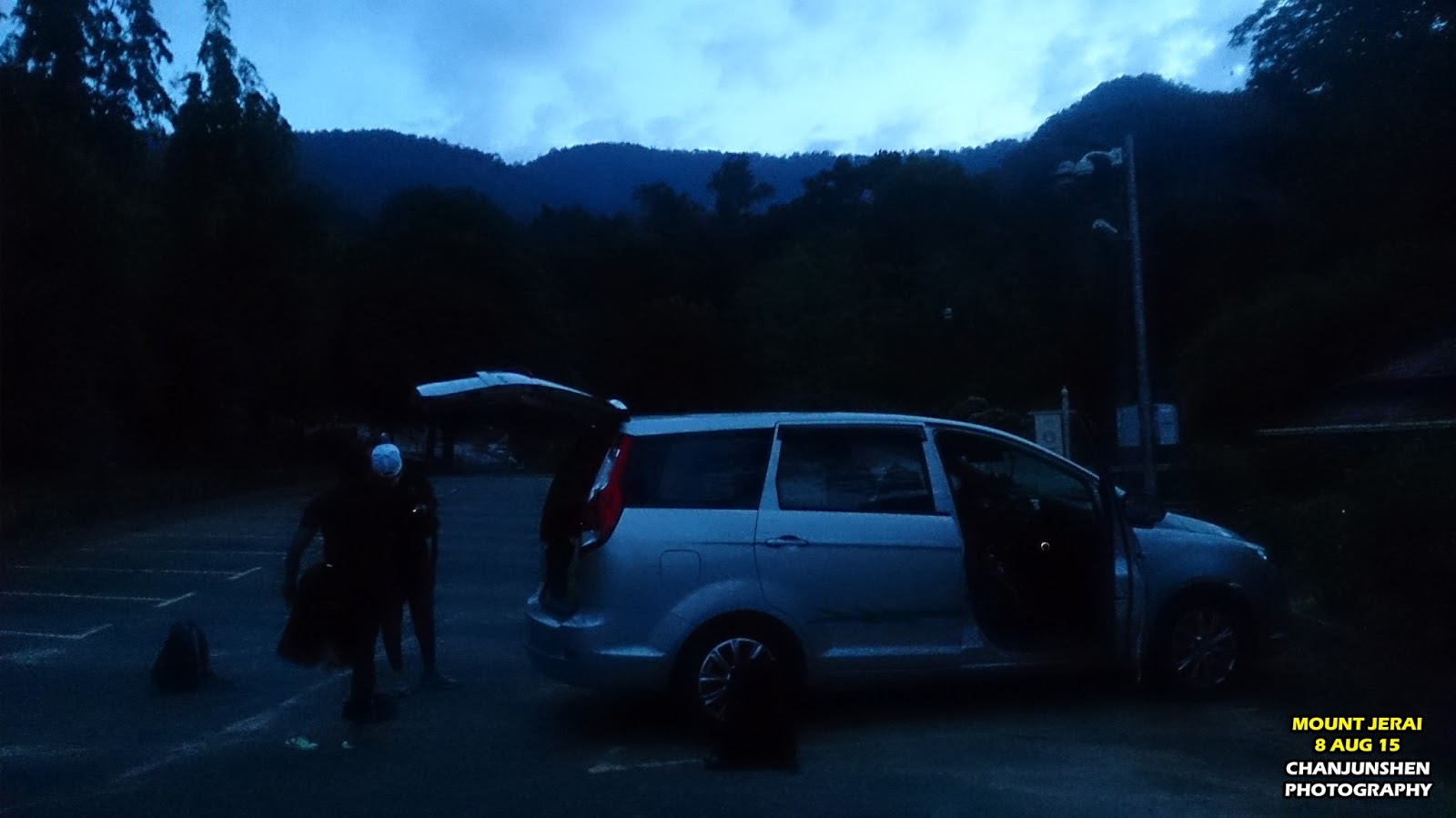
Since not everyone owns a Garmin, I plotted the course in Garmin Connect before transferring it to MapMyRun Android apps. I insisted everyone to get it installed and make sure the map is in their phone. 0500H in the morning; once everyone confirmed that all GPSs are working and all gears ready, we pushed off from Kepala Batas Airport to Lembah Bujang Archaeology Museum. Our team stopped at R&R Gurun for my muslim friends to perform Subuh prayers, then arrived at Lembah Bujang 0655H. Parking was pretty convenient and safe with CCTV monitoring, it is located few hundred meters from the trail entrance. 
Subuh prayers at R&R Gurun.

Arrived early to get everything ready.

We geared up, warmed up and prayed before entering the trail around 0715H as the trail gets brighter. My Garmin locked pretty fast with GLONASS, so I walked across the waterfall towards the old wooden house confidently. The double storey house was abandoned since I came here 2 years ago, I have no idea how long it has been there. At the back of the house, there is a junction where you can use the left or the right trail; either way will lead to the same trail later (left trail is shorter and is marked with an orange arrow). 


The old house after the first waterfall.

We turned right after the old house. 

A few minutes later we reached a junction and we made a right turn just as what was set in my Garmin. Along the way there were plenty of boar digging signs, perhaps because it is near to water source and rhizomes. Then we heard wild boar's sound in the bush and saw a juvenile ran past us, stopped for a moment to let them pass. We reached the second waterfall in 13 minutes’ time since started. 


At this junction, turn right.

Dug out by wild boars.

Crossing the second waterfall.

The orange direction marker and red-white tapes were very useful to us. However, most of it were damaged by weather and fallen trees. I came across many confusing trails during the first 2 kilometers, I have decided to put 100% trust on my Garmin GPS even when I didn’t see any trail ahead. The jungle changes every night so does the trail, always bring your Garmin. 
The orange markers along the way.

“If you’re an aviator disorientated in the cloud, you have to trust your instruments.” 
*The sun has always been on our right side after the waterfall (useful guide for direction)*

After seeing “Ke Puncak Jerai 6km (6km to Mount Jerai)”, we hiked up the rocky slope using the ropes. Then we reached Hutan Terbakar (Burned Forest) at 2.68km (Lap1 in my Garmin 920xt). 2 years ago when I raced here, the ground was all black and burned trees fell everywhere. As for this time, the fern leaves flourish and I just noticed what an awesome view of the shoreline from this point! The 4 islands opposite Mount Jerai could be seen so clearly, it compelled us to stop for a photography break=p


Hike up the rocky slope.

The burned patch at Hutan Terbakar.

A must-have photo at Hutan Terbakar.

Group photo with the team=) Sport Camera JVC Adixxion XA2.

The leeches along the way were everywhere, every 200m there will be one following you. They erect from the ground waiting for passerby, hop on, poke through the socks and suck the blood out. Also, I noticed that the leech could not penetrate compression wear. I would highly recommend hikers to wear calf guards and compression wear underneath. Inevitably, spider webs covered all over my body as I was the one walking in front. Thank God I had a cap and wore my spec.
Next time I'll come with long sleeve. =p
We hiked up another slope with rocky steps (Lap3 in my Garmin 920xt), I called it the Sisik Naga (Dragon Scale) because there’s a stainless steel signboard explaining about a type of plant called the Sisik Naga. At this area, I saw a lot of crystal looking rocks similar to the one at Gunung Keriang. Some of the stones here look like shinny glass, when it shatters on the ground it does look like scales. May be this is how the legend about Dragon Scale started (I am not sure).
My team mate 2nd Lt Anam accidentally stepped on this scorpion but luckily the tail only poked his shoes' outsole. Imagine if he came barefooted. 

Climbed up the rocky steps at Sisik Naga.

The shinny rock. I did not bring any rocks back. 
Took nothing but photographs, left nothing but footprints.

The journey continued to Kepala Angin, our next pit stop. The trails gets chilly, I start to see air plants and moss, no more 20m high trees on top of our head, we could see the sky better now. Arrived at Kepala Angin in 3 hours since we started. Kepala Angin and Hutan Terbakar has the same view, just that Kepala Angin is higher.


Centipedes at Kepala Angin.

Breath taking view at Kepala Angin. 

Pitcher plant could be seen everywhere.

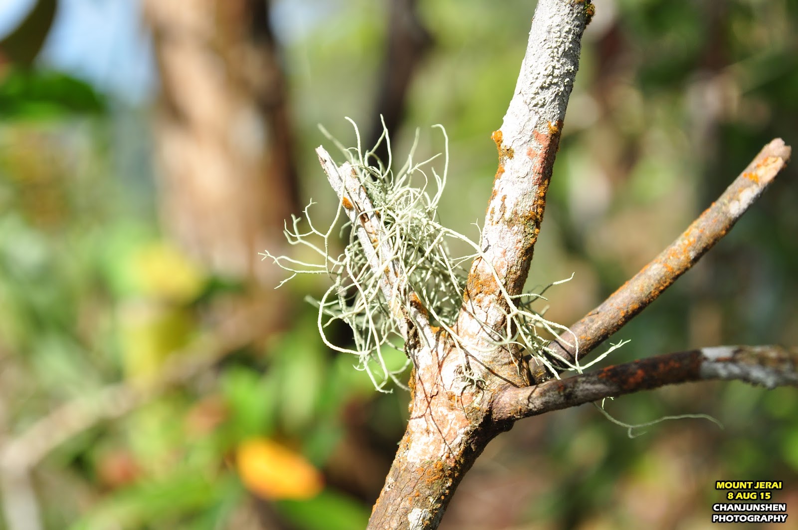
The exotic air plant (Tilllandsia), does not require any soil to grow.

We took around 45 minutes from Kepala Angin all the way up until we reached the tar road to proceed higher heading to the TM Tower (Lap4 in my Garmin 920xt). Non military personnel are not allowed to proceed towards the military post guarding the TM Tower. Up to this location, 3 hours 51 minutes. 1 hour ahead of my planned time!

No trespassing for non military personnel. Lt Izlan and I were the only Navy Officers in the group.

We dropped by Padang Tok Sheikh (Lap5 in my Garmin 920xt) for sight seeing, very awesome view! Then we decided to descend down to The Regency Jerai Hill Resort. Descended halfway, it was too far for us so we turned back. We rested on the road, took out our black pepper chicken and rehydrated ourselves. 

Junction to Padang Tok Sheikh.

Prayers.

High protein meal, just enough to fuel our tummy before descending. We packed up our rubbish to be brought down and kept the jungle clean.

Optionally, we could descend via Tangga Kenari and end up at Yan (Northen Side of the Mountain) or go to the Resort and charter a van down to Yan. Since our car was parked at Merbok (Southern Side of the Mountain), we descended the same way we came up, only with much higher pace. The tree roots and ropes were very helpful on the descend. We moved in a group and took turn to be the guide trekker. 


Skechers GoSpeed3 descending Mount Jerai. I just love the responsiveness!

Although we had 2 Garmin GPS watches and 7 smartphones with maps; theoretically impossible to get lost, we remained cautious and respect the nature as mother nature is the big boss. From time to time we’ll stop to remove leeches, our socks were stained with blood. My chest, my armpit, my neck and my ankles have so many “love bites” now. What an amazing blood sucking creature!


Blood sucking leech, your biggest clingy fan all the way. 

To save time, we did not stop much to take photos. Each break was less than 2 minutes, we only stopped the longest at Hutan Terbakar to enjoy the view for one last time. My initial plan was to get out of the trail latest by 6pm because dark trails could be misleading. From the peak descend down to Lembah Bujang, time taken 2 hours 54 minutes. My water left a few sips only, I’d suggest to carry more than 1.5L in future. We quickly shower at the waterfall after a short break to visit a few more places before going home. Contradict to the weather forecast, heavy rain came pouring at 1730H! I felt relieved to be blessed with good weather along the way and everyone came back safely. 


One last stop at Hutan Terbakar.

Lembah Bujang Archeology Museum area. All my relics and statues pictures inside the museum went missing a day later. Not very sure why and how.


Maharaja Derbar Raja II (descendant of Merong Mahawangsa) was named Makam Sultan Al Mudzaffar Shah 1136-1179. He is the first Kedah’s Sultan who embraced Islam and changed his name to Sultan Muzaffar Shah. The grave is located at Kampung Pengkalan Langgar.

The course I did was longer due to exploration of a few places other than the peak. You can utilize the GPS coordinate to plot your own course. If you are a smart phone user, some areas are covered with thick canopy so the coverage is pretty bad, the apps would stop working. I'd suggest you to invest in a good GPS Garmin watch with navigation feature, because the watch does not require mobile signal. Better still, my Garmin Forerunner 920xt ran with Global Navigation Satellite System which explains how I had full bar of GPS signal at all time. For those who intend to hike up Gunung Jerai, here is the link to the GPS coordinate:


To sum it all, Mount Jerai is worth going. The overall expenditure incurred was around RM23 per person for all the food and gears, plus RM10 for car pooling, and lastly RM25 for a wholesome seafood dinner at Jitra. Only RM58 needed to climb a mountain, but of course some level of fitness is required to make sure everyone come home safely. Should you have any problem, do send me an email and I will try my best to answer you. My main intention of writing a comprehensive report is to assist future trekkers and give everyone a better idea of what to expect when hiking the legendary Mount Jerai. Good Luck =)